- Home
- Albums
- Western Europe
- England, Sept. 5-7, 2016
- England/Belgium/Wales, July 5-16, 2005
- France, May 12-29, 2018
- Days 1-3, Paris, Mont Saint-Michel
- Day 4, Notre Dame; Marais
- Day 5, Normandy
- Day 6, Rodin Museum; Seine Cruise
- Day 7, Paris: City Tour, Musee d’Orsay & l’Orangerie, Montmartre
- Day 8, Champagne; Dijon
- Day 9, Burgundy, Beaune, Lyon
- Day 10, French Alps, Sisteron, Grasse, Cannes
- Day 11, French Riviera
- Day 12, Avignon, Pont du Gard
- Day 13, Carcassonne; Lourdes
- Day 14, Lourdes, Bordeaux Wine Country, Saint-Emilion
- Day 15, Bordeaux
- Days 16-18, Loire Valley, Cognac, Paris
- France/England/Belgium, Sept. 9-26, 2004(A)
- France/England/Belgium, Sept. 9-26, 2004(B)
- Greece/Turkey, Oct. 12-Nov. 5, 2005(A)
- Greece/Turkey, Oct. 12-Nov. 5, 2005(B)
- Greece/Turkey, Oct. 12-Nov. 5, 2005(C)
- Ireland, Sept. 12-28, 2016
- Italy, April 17-May 8, 2005(A)
- Italy, April 17-May 8, 2005(B)
- Italy, April 17-May 8, 2005(C)
- Italy/Switzerland, Sept. 27-Oct. 8, 2007
- Northern Ireland, Sept. 8-12, 2016
- Northern Ireland/Ireland, Sept 8-12, 2016
- Portugal, March 19-April 5, 2008(A)
- Portugal, March 19-April 5, 2008(B)
- Portugal/Spain/France/Andorra, May 29-June 19, 2019
- Days 1-3, Lisbon
- Day 4, Lisbon
- Day 5, Lisbon, Casais, Cabo da Roca, Sintra
- Day 6, Fatima, Porto
- Day 7: Porto, Portugal, to Santiago de Compostela, Spain
- Day 8, Santiago de Compostela & La Coruna
- Day 9, Luarca, Espana Verde, Oviedo
- Day 10, Santander; Bilbao
- Day 11, San Sebastian; French Basque Country
- Day 12, Pamplona; Zaragoza
- Days 13-15, Barcelona
- Day 16, Barcelona
- Day 17, Girona; Figueres: Salvador Dali Museum
- Days 18-19, Barcelona
- Day 20, Three-Country Tour; Monserrat
- Day 21, Barcelona, Going Home
- Scotland, July 18-23, 2005
- Spain, Oct. 13-18, 2006(A)
- Spain, Oct. 13-18, 2006(B)
- Spain, Oct. 24-25, 2010
- Canada
- British Columbia, Feb. 24-28, 2005
- Maritimes, Oct. 5-15, 2015, 2015
- Days 1&2: Lunenburg/Mahone Bay, Nova Scotia
- Day 3: Nova Scotia to Prince Edward Island
- Day 4: Prince Edward Island
- Day 5: Prince Edward Island to Cape Breton, Nova Scotia
- Day 6: Cabot Trail, Nova Scotia
- Day 7: Cheticamp to Baddeck, Nova Scotia
- Day 8: Louisbourg Fortress & Baddeck, Nova Scotia
- Day 9: Peggy’s Cove & Titanic Graves, Nova Scotia
- Days 10 & 11: Halifax, Nova Scotia
- Quebec, July 16-22, 2018
- Asia
- Cambodia, Jan. 14-20, 2012
- China, Feb. 5-16, 2010
- Days 1 & 2, Beijing: Qian Men
- Day 2(con’t): Beijing: Tianamen Square, etc.
- Day 3(A), Beijing: Tai Chi, Tiananmen Square
- Day 3(B), Beijing: Forbidden City
- Day 3(C), Beijing: Summer Palace, etc.
- Day 4(A), Beijing: Olympic Stadium, etc.
- Day 4(B), Great Wall of China
- Day 5(A), Beijing: Lama Temple
- Day 5(B), Beijing: Hutongs, House of Madame Sun Yat-sen, Tea Shop, Hot Pot
- Day 6, Beijing: BeiHai and Jingshan Parks
- Day 7, Beijing: Temple of Heaven; to Xian
- Day 8(A), Xian: Pagoda, Jade Store
- Day 8(B), Xian: Terra Cotta Warriors
- Day 8(C), From Warriors to Dumplings
- Day 9, Shanghai: Yu Gardens, etc.
- Day 10, Shanghai/Suzhou: Gardens, etc.
- Days 11 & 12, Shanghai/Zhouzhuang; Going Home
- India, Nov. 17-26, 2014
- Japan, April 17-24, 2009
- Malaysia, Jan. 12-14, 2012
- Myanmar, Jan. 26-Feb. 4, 2016
- Nepal, Nov. 27-30, 2014
- Singapore, Jan. 8-11, 2012
- South Korea, January 15-18, 2016
- Sri Lanka, Jan. 13-Feb. 1, 2019
- Days 1-4, Negombo
- Day 5, Negombo to Habarana, Minneriya Nat’l Park
- Day 6, Hiriwadunna Village, Polonnaruwa
- Day 7, Sigiriya Rock Fortress, Dambulla Cave Temple, Spice & Herbal Garden
- Day 8, Kandy: City & Temple of the Tooth Relic
- Day 9, Tea Plantations, Nuwara Eliya
- Day 10, Nuwara Eliya to Yala Nat’l Park
- Day 11, Yala Beach & Nat’l Park
- Days 12&13, Yala to Weligama Bay to Galle
- Day 14, Madu River, Sea Turtle Center, Colombo
- Day 15, Colombo, Anuradhapura
- Day 16, Anuradhapura to Jaffna
- Day 17, Delft Island, Jaffna
- Days 18&19, Jaffna to Wilpattu National Park to Negombo
- Thailand, Jan. 17-Feb. 2, 2014
- Days 1-3, Bangkok
- Day 4, Thailand
- Day 5, Bangkok
- Day 6, River Kwai/Death Railway
- Day 7, Bangkok
- Day 8, Bangkok
- Day 9, Summer Palace, Ayutthaya
- Day 10, Sukhothai
- Day 11, Chiang Rai
- Day 12A, Thailand/Myanmar Border
- Day 12B, The Golden Triangle
- Day 13, Chiang Rai to Chiang Mai
- Day 14, Chiang Mai
- Days 15 & 16, Chiang Mai, Bangkok, Going Home
- Thailand, Jan. 18-26, 2016
- Vietnam, Jan. 20-30, 2013
- Tour Day 3(B) & 4(A), Ho Chi Minh City: At Night and Flower Festival
- Tour Day 4(B), Ho Chi Minh City, City Tour
- Tour Day 4(C&D), Nearby Ho Chi Minh City, to the Cu Chi Tunnels
- Tour Days 5 & 6, Hoi An
- Tour Day 7(A), Hoi An to Hue
- Tour Day 8, Hue: The Perfume River
- Tour Day 9, Hanoi to Halong Bay
- Tour Day 10, Halong Bay
- Tour Day 11, Hanoi
- Tour Day 12, Near Hanoi
- Southern Africa, Sept. 3-20, 2017
- Days 1-4, Cape Town, South Africa
- Day 5, Cape Town, South Africa
- Day 6, Western Cape Winelands, South Africa
- Day 7, Zululand & St. Lucia, South Africa
- Day 8, Hluhluwe Game Reserve, South Africa; Swaziland
- Day 9, Swaziland; South Africa
- Day 10, Kruger National Park, South Africa
- Day 11, Panorama Route, South Africa
- Day 12, Soweto, Johannesburg, South Africa
- Day 13, Zambia, Zimbabwe
- Day 14, Victoria Falls, Zimbabwe
- Day 15, Botswana
- Day 16, Botswana Game Drives
- Day 17, Botswana-Zambia
- Australia/New Zealand, March 22-April 8, 2017
- South America
- Argentina, 2015
- Brazil, 2015
- Brazil/Argentina, 2015
- Chile, 2015
- Colombia, 2016
- Peru, Aug. 19-Sept. 5, 2018
- Days 1&2, Lima
- Day 3, Lima’s Shantytowns
- Day 4, Paracus, Nazca Lines
- Day 5, Lima Photo Tour
- Day 6, Lima Cultural Tour/Larcomar
- Day 7, Lima, Pachacamac, Larco Museum
- Day 8, Cuzco Ruins
- Day 9, Machu Picchu, Sacred Valley
- Day 10, Cuzco
- Day 11, Cuzco to Raqchi & Puno
- Day 12, Lake Titicaca, Children’s Parade, Sillustani Tombs
- Days 13&14, Colca Canyon
- Days 15-17, Arequipa, Home
- Egypt, Jan. 19-17, 2011
- Central/Eastern Europe-1, April 23-May 8, 2011
- Days 1&2, Frankfurt-am-Main, Germany
- Day 3, Frankfurt to Berlin via Weimar
- Day 4 (Part 1), Berlin
- Day 4 (Part 2), Potsdam, Germany
- Day 5, Berlin to Warsaw via Poznan
- Day 6, Warsaw
- Day 7, Warsaw to Krakow via Jasna Gora and Auschwitz
- Day 8, Krakow
- Day 9, Poland, Slovakia, Hungary
- Day 10, Budapest
- Day 11, Vienna
- Day 12, Vienna to Prague
- Central/Eastern Europe-2, April 23-May 8, 2011
- Central/Eastern Europe
- Eastern Europe
- Balkans Tour, June 15-July 2, 2017
- Days 1-4, Montenegro/Albania
- Days 5&6, Dubrovnik, Croatia
- Day 7, Montenegro
- Day 8, Bosnia and Herzegovina
- Day 9, Bosnia and Herzegovina
- Day 10, Split, Croatia
- Day 11, Zadar
- Day 12A, Plitvice National Park
- Day 12B, Zagreb
- Day 13, Zagreb, Kumrovec
- Day 14, Ljubljana, Lake Bled, Slovenia
- Day 15, Postojna Caves/Predjama Castle, Slovenia
- Days 16-18, Vienna, Bratislavia
- Bulgaria, April 25-28, 2014
- Romania, April 28-May 3, 2014
- Russia, Sept. 9-20, 2013
- Serbia, April 24-25, 2014
- Turkey, April 11, 2014
- Balkans Tour, June 15-July 2, 2017
- United States
- California
- Art Show 2015
- California Flowers
- Central Coast, March 9-11, 2006
- Central Coast, Dec. 14-16, 2009
- Central Coast, Rails, Whales, & Dunes, March 7-9, 2018
- Los Angeles: Day of the Dead Procession, 2014
- Los Angeles: Little Tokyo, Nov. 17, 2009
- Oak Glen, Oct. 25, 2011
- Reagan Library, Simi Valley
- Riverside-Chino: Christmas, Dec. 20, 2011
- San Diego, June 16, 2006
- San Diego, Sept. 5-6, 2009
- San Diego: Miramar Air Show, Sept. 30, 2011
- San Francisco, Feb. 21-23, 2005
- San Francisco, June 26-29, 2005
- Santa Barbara Wine Country, Feb. 13, 2005
- Chicago
- Florida, May 4-10, 2006
- Grand Canyon West, Oct. 24-26, 2017
- Hawaii, March 1-3, 2010
- Idaho/Washington/Montana, June 9-12, 2007
- Las Vegas
- New Mexico
- New York, July 25-Aug. 4, 2008
- Oregon, March 15-20, 2006
- Washington: Seattle, Feb. 23-24, 2005
- Yellowstone in Winter, Jan. 24-29, 2015
- California
- Morocco, Oct. 14-24, 2010
- Central America
- Caribbean
- Scandinavia/Estonia»
- Iceland
- Middle East
- Dubai & Abu Dhabi, Nov. 19-26, 2013
- Israel/West Bank/Jordan, Jan. 17-31, 2020
- Days 1-3, Tel Aviv
- Day 4, Gaza Border Reality Tour
- Day 5, Tel Aviv Food Tour & Art Museum
- Day 6, Jaffa, Tel Aviv, Caesarea, Capernaum, Sea of Galilee
- Day 7, Mount of Beatitudes, Safed, Kibbutz, Winery, Golan Heights
- Day 8, Diamonds, Beit She’an, Western Wall, Jerusalem
- Day 9, Masada, Dead Sea, and Light Show
- Day 10, Bethlehem
- Day 11, Petra, Jordan
- Day 12, Jerusalem Old City: Stations of the Cross
- Day 13, Hebron, West Bank
- Day 14, Temple Mount and Mount of Olives
- Western Europe
- Slide Shows
- Asia-1
- Cambodia
- Phnom Penh: On the Road, Day 2(A)
- Phnom Penh: Tuol Sleng Genocide Museum/The Killing Fields, Day 2(B)
- Phnom Penh: Mekong Sunset Tour-1, Day 2(C)
- Phnom Penh: Mekong Sunset Tour-2, Day 2(C)
- Phnom Penh: Discovery Tour-1, Day 3
- Phnom Penh: Discovery Tour-2, Day 3
- From Phnom Penh to Siem Reap-1, Tour Day 1
- Siem Reap: Angkor Thom, Tour Day 2(A)
- Siem Reap: Ta Phrohm, Tour Day 2(B)
- Siem Reap: Angkor Wat, Tour Day 2(C)
- Near Siem Reap: Ox-cart Ride, Tonle Sap Boat Trip, Tour Day 3(A)
- China
- India
- Day 3A: Delhi
- Day 3B: Delhi
- Day 3C: Delhi
- Day 4A: Delhi to Jaipur
- Day 4B: Delhi to Jaipur
- Day 5A: Jaipur
- Day 5B: Jaipur
- Day 6A: Jaipur to Abhaneri
- Day 6B: Abhaneri to Agra
- Day 7A: Agra, The Taj Mahal
- Day 7B: Agra, At the Taj Mahal
- Day 7C: Tomb & Agra Fort
- Day 7D: Driving Around Agra
- Day 8A: Agra to Orchha
- Day 8B: Orchha to Khajuraho
- Day 9A: Khajuraho
- Day 9B: Varanasi
- Day 10A: Varanasi
- Day 10B: Sarnath
- Japan
- Japan: Raw and Packaged Food
- Japan: Restaurant Food
- Japan: Shopping
- Japan: Signs
- Japan: Sweets
- Kamakura: Rickshaw Ride
- Mt. Kamagatake (Hakone-en): Cable Car Ride
- Nikko: Nikko Toshogu Shrine
- Tokyo: Central Wholesale Fish Market
- Tokyo: Imperial Palace East Garden
- Tokyo: Little Hong Kong
- Tokyo: Sumida River Cruise
- Tokyo: Tokyo at Night
- Tokyo: Views from Tokyo Tower
- Malaysia
- Nepal
- Singapore
- Singapore Walk, Day 1(A)
- Singapore Wallk, Day 1(B)
- Singapore Botanic Gardens, Day 2(A)
- Asian Food, Day 2(B)
- Buffalo Street, Little India, Day 3(A)
- Chinatown, Day 3(B)
- Night Tour, Day 3(C)
- Sri Veeramakaliamman Hindu Temple, Day 4(A)
- Haw Par Villa–1, Day 4(B)
- Haw Par Villa–2, Day 4(C)
- Sentosa Mosiac Dragon, Day 4(D)
- South Korea
- Thailand-1
- Ayutthaya Historical Park
- Bangkok: Chao Phraya River Cruise
- Bangkok: Chao Phraya Night Cruise
- Bangkok: City Tour
- Bangkok: Emerald Buddha/Grand Palace
- Bangkok: Wat Po
- Bang Pa-In Summer Palace
- Canal Cruise, Floating Market, Rose Garden
- Damnoen Saduak Canal Boat Ride
- Damnoen Saduak Floating Market
- Death Railway POW Cemetery & Museum
- From Ayutthaya to Sukhothai
- From Sukhothai to Chiang Rai
- River Kwai/Death Railway
- Sukhothai Historical Park
- Wat Rong Khun: The White Temple
- Thailand-2
- Thailand-3
- Cambodia
- Asia-2
- Myanmar
- Bagan: Day 1
- Bagan: Day 2A
- Bagan: Day 2B
- Inle Lake: Day 1A
- Inle Lake: Day 1B
- Inle Lake: Day 2
- Mandalay: Day 1
- Mandalay: Day 2A
- Mandalay: Day 2B
- Pyin Oo Lwin
- Tachileik-1: Border, Market
- Tachileik-2: Two Temples
- Tachileik-3: Border, Knock-offs
- Yangon: Driving Around
- Yangon: Places Visited
- Yangon: Shwedagon Pagoda
- Sri Lanka
- Anuradhapura
- Anuradhapura to Jaffna
- Colombo to Anuradhapura
- Dambulla Cave Temple
- Delft Island-1
- Delft Island-2
- Delft Island-3
- Galle: Buddhist Monastery
- Galle Fort-1
- Galle Fort-2
- Glenloch Tea Factory
- Hiriwadunna Village
- Jaffna
- Jaffna to Wilpattu to Negombo
- Kandy: City & Temple of the Tooth Relic
- Kandy to Nuwara Eliya
- Kosgoda: Sea Turtle Research & Conservation Center
- Madu River Safari
- Minneriya National Park
- Negombo
- Negombo to Habarana
- Nuwara Eliya to Yala Nat’l Park
- Polonnaruwa
- Sigiriya Rock Fortress
- Wilpattu National Park
- Yala Beach
- Yala National Park
- Yala to Weligama Bay to Galle
- Vietnam-1
- Ho Chi Minh City: Flower Festival, Tour Days 3(B) & 4(A)
- Ho Chi Minh City: City Tour, Tour Day 4(B)
- Nearby Ho Chi Minh City: Going to the Cu Chi Tunnels, Tour Day 4(C)
- Nearby Ho Chi Minh City: Cu Chi Tunnels, Tour Day 4(D)
- Hoi An: Old City-1, Tour Days 5 & 6(A)
- Hoi An: Old City-2, Tour Day 6(B)
- Hoi An: Thu Bon River Cruise, Tour Day 6(C)
- Hoi An: Tra Que Herb Village, Tour Day 6(D)
- Vietnam-2
- Hoi An to Hue, Tour Day 7(A)
- Hue: The Citadel, Tour Day 7(B)
- Hue: Cyclo Ride and Dinner, Tour Day 7(C)
- Hue: Perfume River-1, Tour Day 8
- Hue: Perfume River-2, Tour Day 8
- Hanoi to Halong Bay, Tour Day 9
- Halong Bay: Tour Day 10
- Hanoi: Museum, Old City, Water Puppets, Tour Day 11(A)
- Hanoi: Hanoi Hilton (Hoa Lo Prison Historical Site), Tour Day 11(B)
- Near Hanoi: Thay Pagoda, Day 12(A)
- Near Hanoi: Vietnam Village, Day 12(B)
- Gate 1 Tourmates’ Photos, Vietnam and Cambodia
- Myanmar
- Australia/New Zealand
- New Zealand
- Auckland: City Tour
- Auckland: Waiheke Island
- Auckland: Waitakere Ranges Park
- Dunedin: City Tour
- Dunedin: Otago Peninsula Tour
- Dunedin to Christchurch
- Milford Sound
- Queenstown: Skippers Canyon-1
- Queensland: Skippers Canyon-2
- Queenstown to Dunedin-1
- Queenstown to Dunedin-2
- Queenstown: The Town
- Queenstown to Milford Sound
- Queenstown: TSS Earnslaw Cruise
- Australia
- New Zealand
- Iceland
- South America
- Argentina
- Brazil
- Brazil/Argentina
- Chile
- Colombia-1
- Bogota: Botero Museum; Monserrate
- Bogota: City Tour
- Bogota Graffiti Murals-1
- Bogota Graffiti Murals-2
- Bogota Photography Tour-1
- Bogota Photography Tour-2
- Bogota Photography Tour-3
- Bogota: Salt Cathedral of Zipaquira/Tejo
- Cocora Valley: Eco Tour/Coffee Plantation
- Day trip to Villa de Leyva-1: Raquira
- Day trip to Villa de Leyva-2
- Zona Cafetera/Cocora Valley/Salento
- Colombia-2
- Peru
- Western Europe
- Belgium
- England
- France-1
- French Basque Country
- Giverny: Monet’s Water Gardens
- Giverny: Monet’s Flower Gardens
- Mont Saint-Michel
- Normandy-1
- Normandy-2
- Paris: City Tour
- Paris: Marais Pastry & Wine Tour
- Paris: Montmartre
- Paris: Musee de l’Orangerie
- Paris: Musee d’Orsay (2004)
- Paris: Musee d’Orsay (2018)
- Paris: Notre Dame
- Paris: Rodin Museum
- Paris: Seine Cruise
- Paris: The Louvre
- Paris: View from the Eiffel Tower
- Versailles
- France-2
- Greece
- Ireland
- Book of Kells, Guinness Storehouse, Archaelogy Museum
- Cahir Castle & Waterford
- Cobh (Queenstown)
- Connemara/Kylemore Abbey
- Cork: City Tour
- County Galway to County Kerry
- Dingle Peninsula
- Dublin: Cathedral, Castle, Cemetery
- Dublin Doors
- Dublin: Sights
- Galway: Aran Islands
- Galway: City Tour
- Glendalough Valley, Powerscourt House
- Kilkenny Walk
- Killarney: Drive Around
- Killarney: Walk Around
- Killarney to Blarney Castle
- Kilmainham Gaol & Howth
- Ring of Kerry
- Italy-1
- Italy-2
- Northern Ireland
- Northern Ireland/Ireland
- Portugal
- Spain-1
- Avila
- Barcelona 2019
- Barcelona Hop-on Hop-off Bus
- Fundacio Joan Miro
- Gaudi’s Barcelona: Casa Batllo, Casa Mila, Park Guell
- Gaudi’s Barcelona: Sagrada Familia
- Hospital Sant Pau
- Meet Vincent Van Gogh
- Montserrat
- Palau de la Musica Catalana
- Port Cable Car Barcelona
- Sardana Dancers, Barcelona Cathedral, Picasso Museum
- Tapas Walking Tour
- Barcelona: Gaudi’s Casa Mila
- Barcelona: Gaudi’s Parc Guell
- Barcelona: Gaudi’s Sagrada Familia
- Barcelona: Las Ramblas
- Bilbao; Guggenheim Museum
- Cordoba-1
- Cordoba-2
- Figueres: Salvador Dali Museum
- Girona
- Granada: The Alhambra
- La Coruna
- Luarca
- Madrid: Palacio Real
- Madrid: Tapas Walking Tour
- Near Madrid: El Escorial
- Oviedo
- Pamplona
- Ronda: Old Moorish Quarter
- Spain-2
- Spain/France/Andorra
- Switzerland
- Caribbean
- Middle East
- Dubai & Abu Dhabi
- Dubai, Day 1A: City Tour
- Dubai, Day 1B: City Tour
- Dubai, Day 1C: City Tour
- Dubai, Day 2A: Ski Dubai, Dubai Metro
- Dubia, Day 2B: Desert Safari
- Sharjah, Day3A: Museum and Souqs
- Abu Dhabi, Day 4A: Hili Park, Al Ain Oasis & National Museum
- Abu Dhabi, Day 4B: Al Ain Mall, Camel Market, Palace Museum
- Abu Dhabi, Day 5A: City Tour
- Abu Dhabi, Day 5B: Grand Mosque
- Abu Dhabi, Day 5C: Falcon Hospital
- Israel/West Bank/Jordan
- Dubai & Abu Dhabi
- United States
- Arizona/Nevada
- Americana in Williams, AZ
- Broken Arrow Tour–Sedona
- Cruise on the Colorado River
- Grand Canyon
- Grand Canyon Railway
- Hoover Dam, NV/AZ, to Laughlin, NV
- Montezuma Castle
- Monument Valley from Sedona, AZ
- Monument Valley, AZ/UT
- Monument Valley, AZ/UT: Goulding’s
- New Age Sedona
- Oak Creek Canyon to Sedona
- Sedona Sculpture Walk
- Sedona Vortex Tour
- Tlaquepaque, Sedona, AZ
- Uptown Sedona
- California-1
- Anza-Borrego: Wildflowers
- Barstow: Peggy Sue’s ’50’s Diner
- Cambria: East and West Villages
- Carlsbad: Flower Fields
- Catalina Island
- Central Coast, Rails, Whales, & Dunes–1
- Central Coast, Rails, Whales, & Dunes-2
- Chino: Christmas Decorations
- Indio: Date Festival & Riverside County Fair
- La Canada Flintridge: Descanso Gardens
- Lancaster: California Poppy Reserve
- Los Angeles: Becoming L.A.!
- Los Angeles: Chinatown, Jan. 2014, Part 1
- Los Angeles: Chinatown, Jan. 2014, Part 2
- Los Angeles: Day of the Dead Altars-1
- Los Angeles: Day of the Dead Altars-2
- California-2
- LA Graffiti and Mural Tour-1
- LA Graffiti and Mural Tour-2
- Los Angeles: Grand Central Market, 2014
- Los Angeles: Latin Spice Food Tasting Tour
- Los Angeles: Mariachi Plaza & Boyle Heights
- Los Angeles: Mexica New Year
- Montecito: Lotusland, Part 1
- Montecito: Lotusland, Part 2
- Montecito: Lotusland, Part 3
- Montecito: Lotusland, Part 4
- Oak Glen
- California-3
- Pasadena: 2012 Rose Parade
- Pasadena: Curbside Rose Parade-1, 2014
- Pasadena: Curbside Rose Parade-2, 2014
- Pasadena: Curbside Rose Parade-3, 2014
- Riverside: Mission Inn
- Rose Parade 2017A
- Rose Parade 2017B
- Rose Parade 2017C
- San Francisco: Alcatraz Island
- San Francisco: Chinatown Stores
- San Francisco: Victorian Houses
- San Juan Capistrano: Mission San Juan Capistrano
- Venice Beach
- Ventura County: Anacapa Island
- Chicago
- Grand Canyon West CA-NV-AZ
- Hawaii
- Las Vegas Side Trips
- New Mexico
- New York
- New York City: Central Park
- New York City: Harbor Lights Night Cruise
- NYC: Chinatown, Little Italy, Wall Street, Trinity Church
- New York City: Manhattan Island, 3-Hour Cruise
- New York City: Midtown, Soho, Battery Park, etc.
- NYC: Rockefeller Center and Fifth Avenue
- NYC: Uptown, Grant’s Tomb, Harlem, etc.
- Northport: Cow Harbor Day
- Northport: Main Street
- Washington
- Yellowstone in Winter
- Arizona/Nevada
- Central Europe
- Central/Eastern Europe-1
- Market Square, Poznan, Poland
- Warsaw’s Old and New Towns
- Inside Wilanow Castle, Warsaw
- Wilanow Castle: Favorite Portraits
- Jasna Gora Monastery, Czestochowa, Poland
- Auschwitz
- Wawel Castle, Krakow
- Krakow’s Old Town
- Wieliczka Salt Mine, Krakow
- Poland, Slovakia, Hungary
- Danube Walk: Pest Side
- Three Walks Around Stephansdom, Vienna
- Schonbrunn Palace, Vienna
- Vienna 2017-A
- Vienna 2017-B
- Central/Easterm Europe-2
- Eastern Europe-1
- Eastern Europe-2
- Romania
- Russia-1
- Goritsy: Skeksna River, Town
- Goritsy: St. Cyril’s Monastery
- Kizhi
- Mandrogi: Craftsmen Village
- Mandrogi: Vodka Museum
- Moscow: At Night
- Moscow: Novodevichy Convent & Cemetery
- Moscow: Overlook
- Moscow: Red Square
- Moscow: The Kremlin
- Russia River Cruise: (1) Moscow to Urlich
- Uglich, Part A
- Uglich, Part B
- Yaroslavl: Buildings & Town Square
- Yaroslavl: Churches
- Russia-2
- Eastern Europe-3
- Central/Eastern Europe-1
- Canada
- Southern Africa
- Scandinavia/Estonia
- Central America
- El Salvador
- Guatemala
- Antigua-1
- Antigua-2
- Antigua-3
- Antigua, La Azotea Coffee Plantation-1
- Antigua, La Azotea Coffee Plantation-2
- Antigua to Lake Atitlan
- Guatemala City: Drive Around
- Guatemala City: Museos Ixchel and Popol Vuh
- Guatemala City to Petenchel
- Hotel Atitlan at Lake Atitlan
- Lake Atitlan
- Lake Atitlan to Guatemala City
- Panajachel
- Petenchel to Antigua
- Quirigua
- Tikal National Park
- Mexico
- Panama
- North Africa
- Asia-1
- Movies
- Contact
Day Trip to Paracus and the Nazca Lines
Leaving Lima
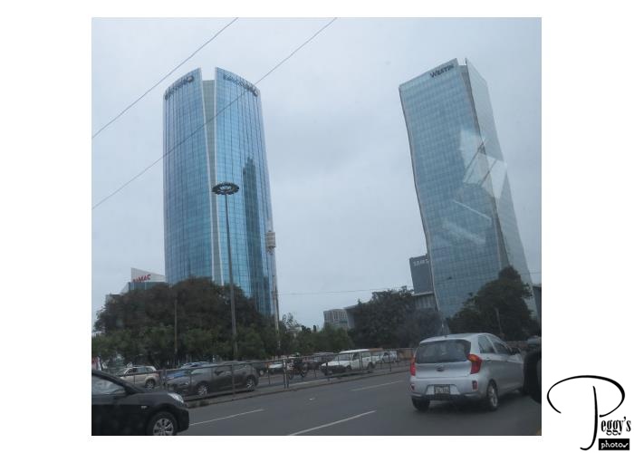
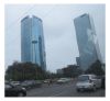
Viajes Pacifico picked me up from my hotel at 7 a.m. to drive to Paracas, a 3–hour drive, to fly over the Nazca Lines. It was the same company that I had some trouble connecting with at the Lima airport for the transfer to my hotel. However, this tour worked out fine. There were two other people on my tour, two men from Mexacali, Mexico, a bordertown with California. They drive up to Los Angeles often and we found we had enough in common to have good conversations. As they both spoke Spanish (one speaking English very well), the tour was conducted in both Spanish and English. We went in a small van with the three of us tour mates, our guide, our driver, and our driver’s assistant. A tour to the Nazca Lines from Lima is expensive and I booked through Viator. The prices for the tour kept changing, so if you want to take the tour, check back with them often for the lowest price. You are not guaranteed that you will go up in the plane to see the Nazca Lines as the flight is weather–related. We were lucky to have good weather for our flight. Some multiday escorted tours of Peru include the Nazca Lines, but whether you will go up to see them is still weather–related. Photo: Passing the upscale financial district of San Isidro in Lima on our way out of Lima.
Leaving Lima
Leaving Lima
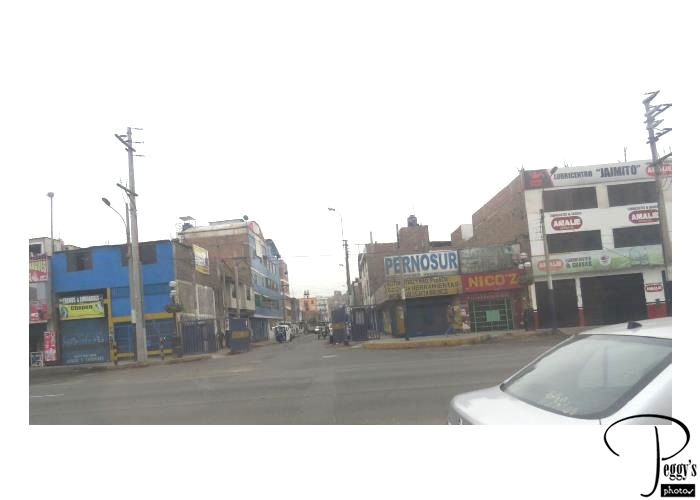
Very soon we were passing Third World Peru on the Pan American Highway traveling south from Lima.
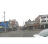
Leaving Lima
Brown Hills

We drove past miles upon miles of arid brown hills. Lima and this area get so little rainfall each year that you could say that it doesn’t rain at all ever. But there is a mist that comes in from the ocean in the morning which does wet the streets and which you actually could mistake for rain. But nothing to relieve the brownness of these hills and ground.
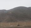
Brown Hills
Resorts
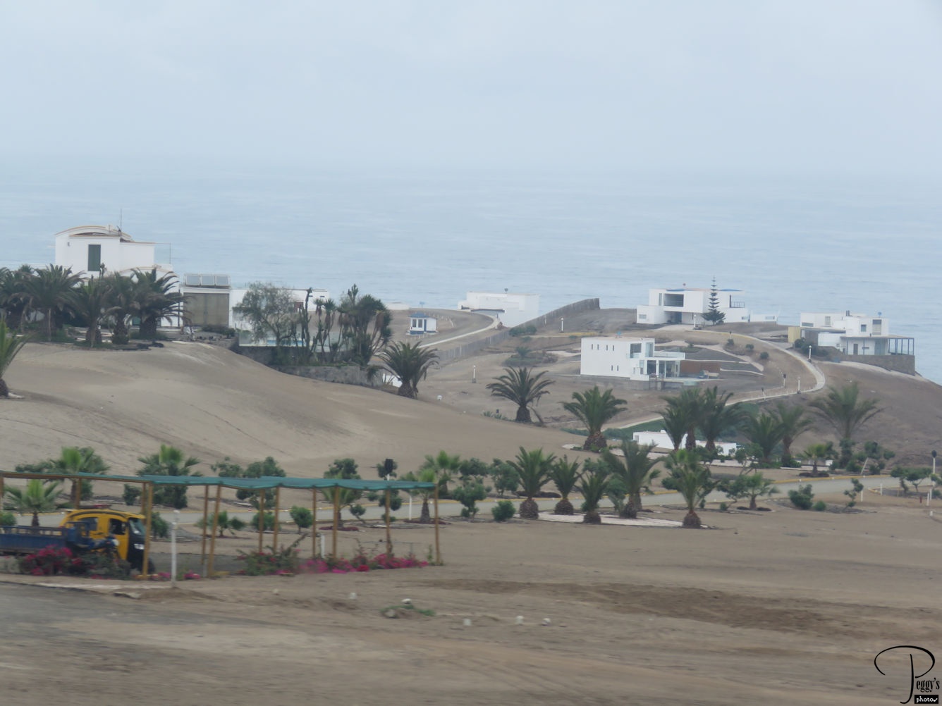
About halfway to Paracas, in a town named, suprisingly, Asia, we were passing some upscale resorts by the ocean. The palm trees would have been watered by sprinklers. The sky was blue here, not like the never–ending overcast skies of Lima that they have during the winter, which was now.
Resorts
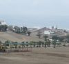
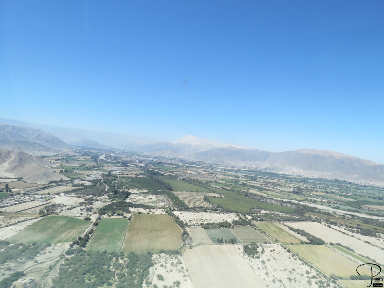
Farms
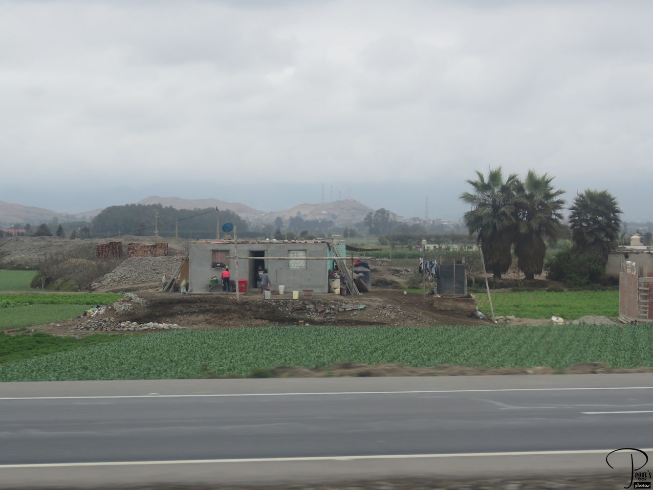
After Asia, there was farmland and welcome greenery. The photo is of a farmhouse.
Farms
Piracas Airport
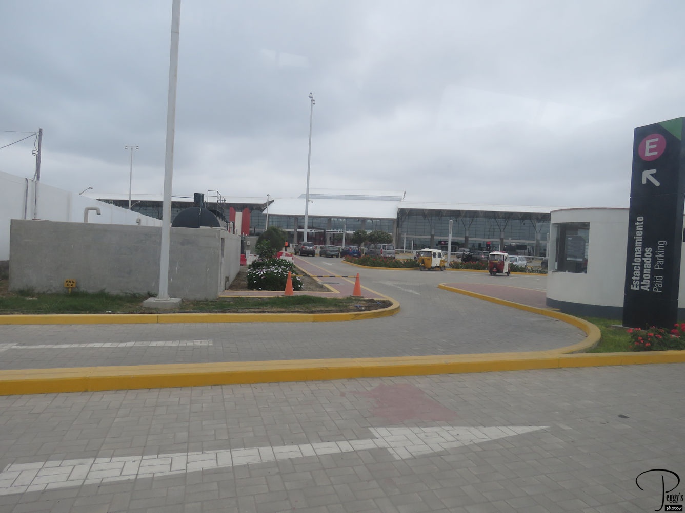
We made it to the modern Piracas Airport in about three hours.
Piracas Airport
Piracas Airport
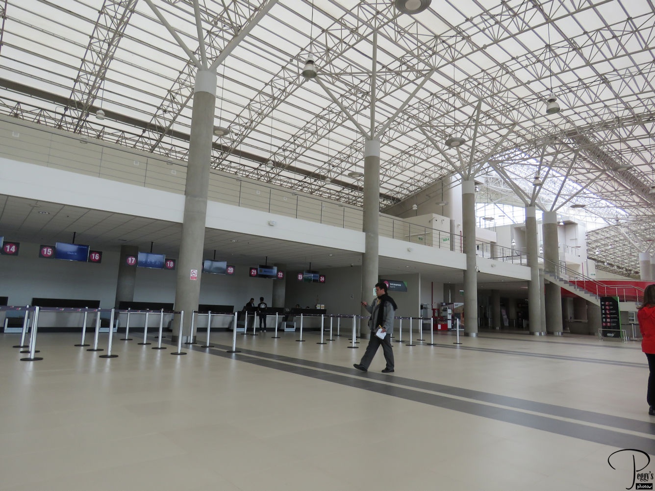
The Piracas Airport was large and virtually empty except for people who would be going to the Nazca Lines. Last Sunday it wasn’t empty as this was where the planes coming into Lima were diverted to when the Lima airport was closed when a plane had to land at it on its belly. We had to go through a regular airport security screening here.
Piracas Airport
Tour Mates & Guide
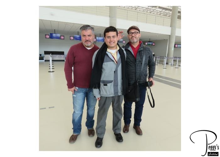
My tour mates from Mexacali and my tour guide, in the middle. Good travel companions.

Tour Mates & Guide
Our Cessna
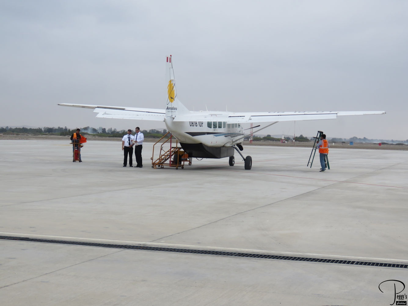
I flew on a Cessna to and from Vieques Island in Puerto Rico and swore that I would never fly on a Cessna again, but here I was about to fly on another one. The flights in Puerto Rico were on a smaller Cessna and the flights were anything but smooth and were scary. It took me quite a while to decide to reserve this tour, but I did not think I would be in Peru again and the Nazca Lines are one of the country’s major sites. Surprisingly, the flight on this Cessna was very smooth going to and from the Nazca Lines.

Our Cessna
In the Air
We flew over a desert of hills and canyons. It took about 1/2 hour of flight time to reach the Nazca Lines.
In the Air
In the Air
We also flew over farmland in the desert canyons.
In the Air
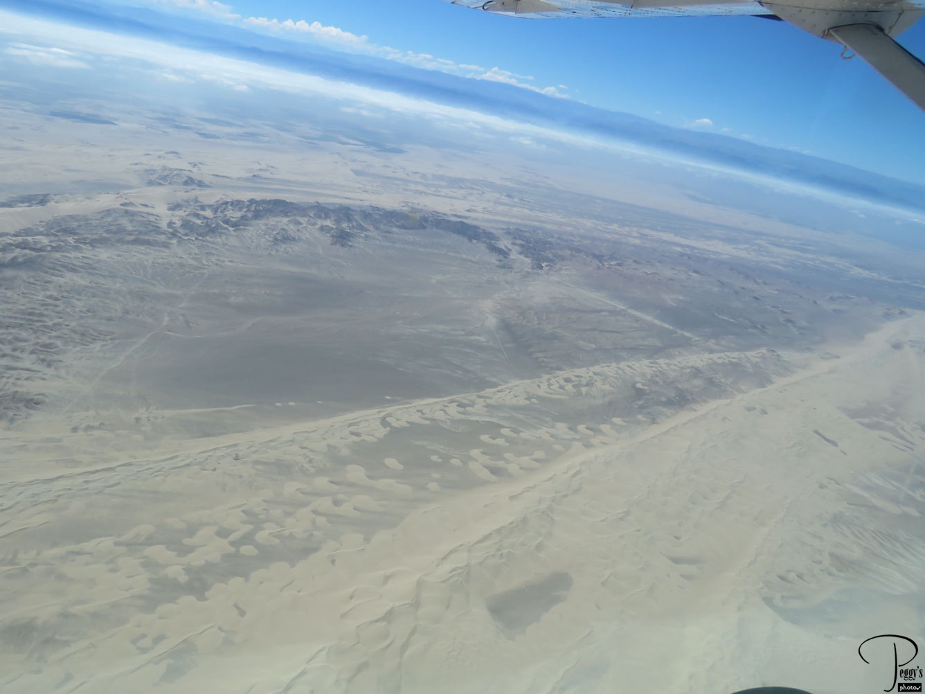
Nazca Lines
The Nazca Lines, which are ancient geoglyps, are on a plateau that stretches more than 50 miles (80 km). It is believed that the Lines were created by the Nazca culture between 500 BC and 500 AD. The first published account of them was in 1553 by Pedro Cieza de Leon. The first to report them were the Peruvian military and civilian pilots and the first scholar to study them was Paul Kosok in 1940–41. Most scholars believe them to have religious meanings.
Nazca Lines
Nazca Lines
This photo is of an aerial view of one of the geoglyps, that of a monkey. Although it is hard to see the monkey in the photo, I could see it from the air when taking the photo. The lines are very light. To show the Lines to people on the left side of the plane, me, the plane’s wing on my side would dip down to almost perpendicular to the ground and also very close to the ground. For people on the other side of the aisle to view the Lines, the wing on our side would be almost straight up. I had read about this in reviews of the tour and had taken a Dramamine, just in case, before the flight. I was fine but found it better to look up when the wing on the other side of the aisle was down rather than taking a look through the window opposite me. One of my Mexacali tour mates reported feeling dizzy during the flight. You can also view the Nazca Lines from one of the nearby hills.
Nazca Lines
Nazca Lines
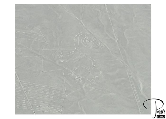
A cropped photo of the monkey.

Nazca Lines
Nazca Lines
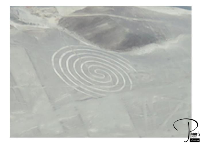
The spiral is the clearest of the geoglyphs from the air.
Nazca Lines
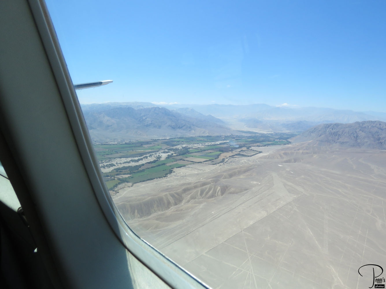
Nazca Lines
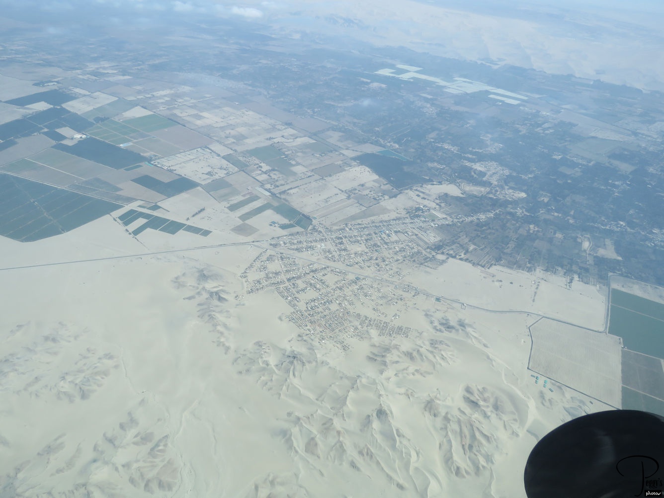
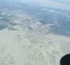
A view of the area where the Nazca Lines are located and the town right near them.
I have put my photos of our flight to see the Nazca Lines on a slideshow. Go to http://www.peggysphotos.com/nazca–lines/
(Slide Shows, South America, Peru, “Nazca Lines”).
Nazca Lines
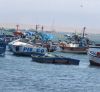
Paracas Harbor
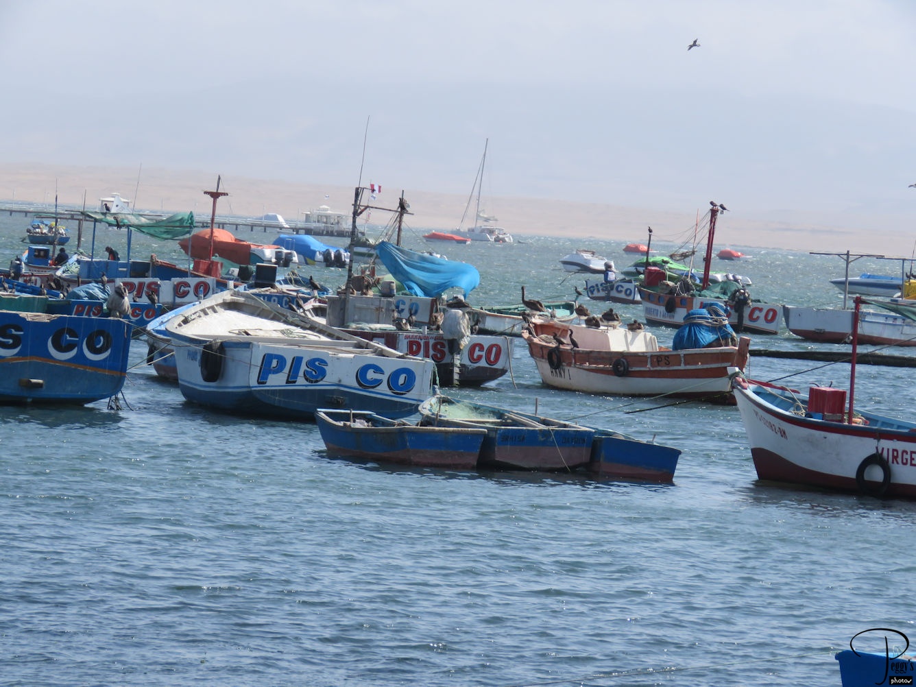
After our flight, we had lunch at the Paracas harbor. Photo: boats in the harbor.
Paracas Harbor
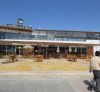
Paracas Harbor
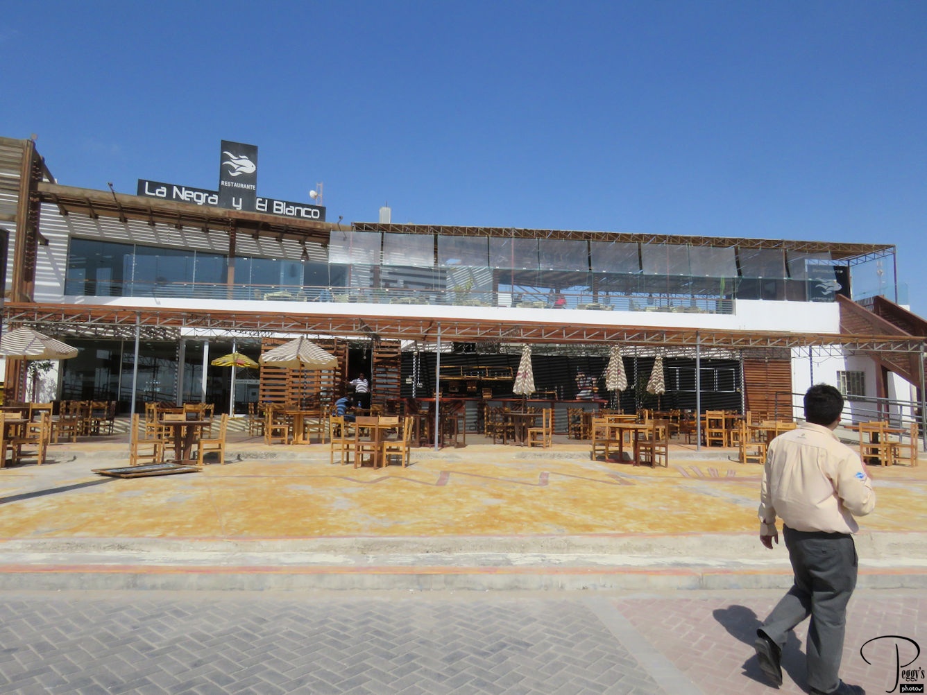
We ate a very nice lunch at the restaurant in this photo in front of the harbor. Here, it was in the 70s, sunny, and beautiful. It was dark by the time we arrived back in Lima.
I have put my photos of our drive from Lima to Paracas on a slideshow. Go to
http://www.peggysphotos.com/nazca–lines/
(Slide Shows, South America, Peru, “Lima to Paracas”).