- Home
- Albums
- Western Europe
- England, Sept. 5-7, 2016
- England/Belgium/Wales, July 5-16, 2005
- France, May 12-29, 2018
- Days 1-3, Paris, Mont Saint-Michel
- Day 4, Notre Dame; Marais
- Day 5, Normandy
- Day 6, Rodin Museum; Seine Cruise
- Day 7, Paris: City Tour, Musee d’Orsay & l’Orangerie, Montmartre
- Day 8, Champagne; Dijon
- Day 9, Burgundy, Beaune, Lyon
- Day 10, French Alps, Sisteron, Grasse, Cannes
- Day 11, French Riviera
- Day 12, Avignon, Pont du Gard
- Day 13, Carcassonne; Lourdes
- Day 14, Lourdes, Bordeaux Wine Country, Saint-Emilion
- Day 15, Bordeaux
- Days 16-18, Loire Valley, Cognac, Paris
- France/England/Belgium, Sept. 9-26, 2004(A)
- France/England/Belgium, Sept. 9-26, 2004(B)
- Greece/Turkey, Oct. 12-Nov. 5, 2005(A)
- Greece/Turkey, Oct. 12-Nov. 5, 2005(B)
- Greece/Turkey, Oct. 12-Nov. 5, 2005(C)
- Ireland, Sept. 12-28, 2016
- Italy, April 17-May 8, 2005(A)
- Italy, April 17-May 8, 2005(B)
- Italy, April 17-May 8, 2005(C)
- Italy/Switzerland, Sept. 27-Oct. 8, 2007
- Northern Ireland, Sept. 8-12, 2016
- Northern Ireland/Ireland, Sept 8-12, 2016
- Portugal, March 19-April 5, 2008(A)
- Portugal, March 19-April 5, 2008(B)
- Portugal/Spain/France/Andorra, May 29-June 19, 2019
- Days 1-3, Lisbon
- Day 4, Lisbon
- Day 5, Lisbon, Casais, Cabo da Roca, Sintra
- Day 6, Fatima, Porto
- Day 7: Porto, Portugal, to Santiago de Compostela, Spain
- Day 8, Santiago de Compostela & La Coruna
- Day 9, Luarca, Espana Verde, Oviedo
- Day 10, Santander; Bilbao
- Day 11, San Sebastian; French Basque Country
- Day 12, Pamplona; Zaragoza
- Days 13-15, Barcelona
- Day 16, Barcelona
- Day 17, Girona; Figueres: Salvador Dali Museum
- Days 18-19, Barcelona
- Day 20, Three-Country Tour; Monserrat
- Day 21, Barcelona, Going Home
- Scotland, July 18-23, 2005
- Spain, Oct. 13-18, 2006(A)
- Spain, Oct. 13-18, 2006(B)
- Spain, Oct. 24-25, 2010
- Canada
- British Columbia, Feb. 24-28, 2005
- Maritimes, Oct. 5-15, 2015, 2015
- Days 1&2: Lunenburg/Mahone Bay, Nova Scotia
- Day 3: Nova Scotia to Prince Edward Island
- Day 4: Prince Edward Island
- Day 5: Prince Edward Island to Cape Breton, Nova Scotia
- Day 6: Cabot Trail, Nova Scotia
- Day 7: Cheticamp to Baddeck, Nova Scotia
- Day 8: Louisbourg Fortress & Baddeck, Nova Scotia
- Day 9: Peggy’s Cove & Titanic Graves, Nova Scotia
- Days 10 & 11: Halifax, Nova Scotia
- Quebec, July 16-22, 2018
- Asia
- Cambodia, Jan. 14-20, 2012
- China, Feb. 5-16, 2010
- Days 1 & 2, Beijing: Qian Men
- Day 2(con’t): Beijing: Tianamen Square, etc.
- Day 3(A), Beijing: Tai Chi, Tiananmen Square
- Day 3(B), Beijing: Forbidden City
- Day 3(C), Beijing: Summer Palace, etc.
- Day 4(A), Beijing: Olympic Stadium, etc.
- Day 4(B), Great Wall of China
- Day 5(A), Beijing: Lama Temple
- Day 5(B), Beijing: Hutongs, House of Madame Sun Yat-sen, Tea Shop, Hot Pot
- Day 6, Beijing: BeiHai and Jingshan Parks
- Day 7, Beijing: Temple of Heaven; to Xian
- Day 8(A), Xian: Pagoda, Jade Store
- Day 8(B), Xian: Terra Cotta Warriors
- Day 8(C), From Warriors to Dumplings
- Day 9, Shanghai: Yu Gardens, etc.
- Day 10, Shanghai/Suzhou: Gardens, etc.
- Days 11 & 12, Shanghai/Zhouzhuang; Going Home
- India, Nov. 17-26, 2014
- Japan, April 17-24, 2009
- Malaysia, Jan. 12-14, 2012
- Myanmar, Jan. 26-Feb. 4, 2016
- Nepal, Nov. 27-30, 2014
- Singapore, Jan. 8-11, 2012
- South Korea, January 15-18, 2016
- Sri Lanka, Jan. 13-Feb. 1, 2019
- Days 1-4, Negombo
- Day 5, Negombo to Habarana, Minneriya Nat’l Park
- Day 6, Hiriwadunna Village, Polonnaruwa
- Day 7, Sigiriya Rock Fortress, Dambulla Cave Temple, Spice & Herbal Garden
- Day 8, Kandy: City & Temple of the Tooth Relic
- Day 9, Tea Plantations, Nuwara Eliya
- Day 10, Nuwara Eliya to Yala Nat’l Park
- Day 11, Yala Beach & Nat’l Park
- Days 12&13, Yala to Weligama Bay to Galle
- Day 14, Madu River, Sea Turtle Center, Colombo
- Day 15, Colombo, Anuradhapura
- Day 16, Anuradhapura to Jaffna
- Day 17, Delft Island, Jaffna
- Days 18&19, Jaffna to Wilpattu National Park to Negombo
- Thailand, Jan. 17-Feb. 2, 2014
- Days 1-3, Bangkok
- Day 4, Thailand
- Day 5, Bangkok
- Day 6, River Kwai/Death Railway
- Day 7, Bangkok
- Day 8, Bangkok
- Day 9, Summer Palace, Ayutthaya
- Day 10, Sukhothai
- Day 11, Chiang Rai
- Day 12A, Thailand/Myanmar Border
- Day 12B, The Golden Triangle
- Day 13, Chiang Rai to Chiang Mai
- Day 14, Chiang Mai
- Days 15 & 16, Chiang Mai, Bangkok, Going Home
- Thailand, Jan. 18-26, 2016
- Vietnam, Jan. 20-30, 2013
- Tour Day 3(B) & 4(A), Ho Chi Minh City: At Night and Flower Festival
- Tour Day 4(B), Ho Chi Minh City, City Tour
- Tour Day 4(C&D), Nearby Ho Chi Minh City, to the Cu Chi Tunnels
- Tour Days 5 & 6, Hoi An
- Tour Day 7(A), Hoi An to Hue
- Tour Day 8, Hue: The Perfume River
- Tour Day 9, Hanoi to Halong Bay
- Tour Day 10, Halong Bay
- Tour Day 11, Hanoi
- Tour Day 12, Near Hanoi
- Southern Africa, Sept. 3-20, 2017
- Days 1-4, Cape Town, South Africa
- Day 5, Cape Town, South Africa
- Day 6, Western Cape Winelands, South Africa
- Day 7, Zululand & St. Lucia, South Africa
- Day 8, Hluhluwe Game Reserve, South Africa; Swaziland
- Day 9, Swaziland; South Africa
- Day 10, Kruger National Park, South Africa
- Day 11, Panorama Route, South Africa
- Day 12, Soweto, Johannesburg, South Africa
- Day 13, Zambia, Zimbabwe
- Day 14, Victoria Falls, Zimbabwe
- Day 15, Botswana
- Day 16, Botswana Game Drives
- Day 17, Botswana-Zambia
- Australia/New Zealand, March 22-April 8, 2017
- South America
- Argentina, 2015
- Brazil, 2015
- Brazil/Argentina, 2015
- Chile, 2015
- Colombia, 2016
- Peru, Aug. 19-Sept. 5, 2018
- Days 1&2, Lima
- Day 3, Lima’s Shantytowns
- Day 4, Paracus, Nazca Lines
- Day 5, Lima Photo Tour
- Day 6, Lima Cultural Tour/Larcomar
- Day 7, Lima, Pachacamac, Larco Museum
- Day 8, Cuzco Ruins
- Day 9, Machu Picchu, Sacred Valley
- Day 10, Cuzco
- Day 11, Cuzco to Raqchi & Puno
- Day 12, Lake Titicaca, Children’s Parade, Sillustani Tombs
- Days 13&14, Colca Canyon
- Days 15-17, Arequipa, Home
- Egypt, Jan. 19-17, 2011
- Central/Eastern Europe-1, April 23-May 8, 2011
- Days 1&2, Frankfurt-am-Main, Germany
- Day 3, Frankfurt to Berlin via Weimar
- Day 4 (Part 1), Berlin
- Day 4 (Part 2), Potsdam, Germany
- Day 5, Berlin to Warsaw via Poznan
- Day 6, Warsaw
- Day 7, Warsaw to Krakow via Jasna Gora and Auschwitz
- Day 8, Krakow
- Day 9, Poland, Slovakia, Hungary
- Day 10, Budapest
- Day 11, Vienna
- Day 12, Vienna to Prague
- Central/Eastern Europe-2, April 23-May 8, 2011
- Central/Eastern Europe
- Eastern Europe
- Balkans Tour, June 15-July 2, 2017
- Days 1-4, Montenegro/Albania
- Days 5&6, Dubrovnik, Croatia
- Day 7, Montenegro
- Day 8, Bosnia and Herzegovina
- Day 9, Bosnia and Herzegovina
- Day 10, Split, Croatia
- Day 11, Zadar
- Day 12A, Plitvice National Park
- Day 12B, Zagreb
- Day 13, Zagreb, Kumrovec
- Day 14, Ljubljana, Lake Bled, Slovenia
- Day 15, Postojna Caves/Predjama Castle, Slovenia
- Days 16-18, Vienna, Bratislavia
- Bulgaria, April 25-28, 2014
- Romania, April 28-May 3, 2014
- Russia, Sept. 9-20, 2013
- Serbia, April 24-25, 2014
- Turkey, April 11, 2014
- Balkans Tour, June 15-July 2, 2017
- United States
- California
- Art Show 2015
- California Flowers
- Central Coast, March 9-11, 2006
- Central Coast, Dec. 14-16, 2009
- Central Coast, Rails, Whales, & Dunes, March 7-9, 2018
- Los Angeles: Day of the Dead Procession, 2014
- Los Angeles: Little Tokyo, Nov. 17, 2009
- Oak Glen, Oct. 25, 2011
- Reagan Library, Simi Valley
- Riverside-Chino: Christmas, Dec. 20, 2011
- San Diego, June 16, 2006
- San Diego, Sept. 5-6, 2009
- San Diego: Miramar Air Show, Sept. 30, 2011
- San Francisco, Feb. 21-23, 2005
- San Francisco, June 26-29, 2005
- Santa Barbara Wine Country, Feb. 13, 2005
- Chicago
- Florida, May 4-10, 2006
- Grand Canyon West, Oct. 24-26, 2017
- Hawaii, March 1-3, 2010
- Idaho/Washington/Montana, June 9-12, 2007
- Las Vegas
- New Mexico
- New York, July 25-Aug. 4, 2008
- Oregon, March 15-20, 2006
- Washington: Seattle, Feb. 23-24, 2005
- Yellowstone in Winter, Jan. 24-29, 2015
- California
- Morocco, Oct. 14-24, 2010
- Central America
- Caribbean
- Scandinavia/Estonia»
- Iceland
- Middle East
- Dubai & Abu Dhabi, Nov. 19-26, 2013
- Israel/West Bank/Jordan, Jan. 17-31, 2020
- Days 1-3, Tel Aviv
- Day 4, Gaza Border Reality Tour
- Day 5, Tel Aviv Food Tour & Art Museum
- Day 6, Jaffa, Tel Aviv, Caesarea, Capernaum, Sea of Galilee
- Day 7, Mount of Beatitudes, Safed, Kibbutz, Winery, Golan Heights
- Day 8, Diamonds, Beit She’an, Western Wall, Jerusalem
- Day 9, Masada, Dead Sea, and Light Show
- Day 10, Bethlehem
- Day 11, Petra, Jordan
- Day 12, Jerusalem Old City: Stations of the Cross
- Day 13, Hebron, West Bank
- Day 14, Temple Mount and Mount of Olives
- Western Europe
- Slide Shows
- Asia-1
- Cambodia
- Phnom Penh: On the Road, Day 2(A)
- Phnom Penh: Tuol Sleng Genocide Museum/The Killing Fields, Day 2(B)
- Phnom Penh: Mekong Sunset Tour-1, Day 2(C)
- Phnom Penh: Mekong Sunset Tour-2, Day 2(C)
- Phnom Penh: Discovery Tour-1, Day 3
- Phnom Penh: Discovery Tour-2, Day 3
- From Phnom Penh to Siem Reap-1, Tour Day 1
- Siem Reap: Angkor Thom, Tour Day 2(A)
- Siem Reap: Ta Phrohm, Tour Day 2(B)
- Siem Reap: Angkor Wat, Tour Day 2(C)
- Near Siem Reap: Ox-cart Ride, Tonle Sap Boat Trip, Tour Day 3(A)
- China
- India
- Day 3A: Delhi
- Day 3B: Delhi
- Day 3C: Delhi
- Day 4A: Delhi to Jaipur
- Day 4B: Delhi to Jaipur
- Day 5A: Jaipur
- Day 5B: Jaipur
- Day 6A: Jaipur to Abhaneri
- Day 6B: Abhaneri to Agra
- Day 7A: Agra, The Taj Mahal
- Day 7B: Agra, At the Taj Mahal
- Day 7C: Tomb & Agra Fort
- Day 7D: Driving Around Agra
- Day 8A: Agra to Orchha
- Day 8B: Orchha to Khajuraho
- Day 9A: Khajuraho
- Day 9B: Varanasi
- Day 10A: Varanasi
- Day 10B: Sarnath
- Japan
- Japan: Raw and Packaged Food
- Japan: Restaurant Food
- Japan: Shopping
- Japan: Signs
- Japan: Sweets
- Kamakura: Rickshaw Ride
- Mt. Kamagatake (Hakone-en): Cable Car Ride
- Nikko: Nikko Toshogu Shrine
- Tokyo: Central Wholesale Fish Market
- Tokyo: Imperial Palace East Garden
- Tokyo: Little Hong Kong
- Tokyo: Sumida River Cruise
- Tokyo: Tokyo at Night
- Tokyo: Views from Tokyo Tower
- Malaysia
- Nepal
- Singapore
- Singapore Walk, Day 1(A)
- Singapore Wallk, Day 1(B)
- Singapore Botanic Gardens, Day 2(A)
- Asian Food, Day 2(B)
- Buffalo Street, Little India, Day 3(A)
- Chinatown, Day 3(B)
- Night Tour, Day 3(C)
- Sri Veeramakaliamman Hindu Temple, Day 4(A)
- Haw Par Villa–1, Day 4(B)
- Haw Par Villa–2, Day 4(C)
- Sentosa Mosiac Dragon, Day 4(D)
- South Korea
- Thailand-1
- Ayutthaya Historical Park
- Bangkok: Chao Phraya River Cruise
- Bangkok: Chao Phraya Night Cruise
- Bangkok: City Tour
- Bangkok: Emerald Buddha/Grand Palace
- Bangkok: Wat Po
- Bang Pa-In Summer Palace
- Canal Cruise, Floating Market, Rose Garden
- Damnoen Saduak Canal Boat Ride
- Damnoen Saduak Floating Market
- Death Railway POW Cemetery & Museum
- From Ayutthaya to Sukhothai
- From Sukhothai to Chiang Rai
- River Kwai/Death Railway
- Sukhothai Historical Park
- Wat Rong Khun: The White Temple
- Thailand-2
- Thailand-3
- Cambodia
- Asia-2
- Myanmar
- Bagan: Day 1
- Bagan: Day 2A
- Bagan: Day 2B
- Inle Lake: Day 1A
- Inle Lake: Day 1B
- Inle Lake: Day 2
- Mandalay: Day 1
- Mandalay: Day 2A
- Mandalay: Day 2B
- Pyin Oo Lwin
- Tachileik-1: Border, Market
- Tachileik-2: Two Temples
- Tachileik-3: Border, Knock-offs
- Yangon: Driving Around
- Yangon: Places Visited
- Yangon: Shwedagon Pagoda
- Sri Lanka
- Anuradhapura
- Anuradhapura to Jaffna
- Colombo to Anuradhapura
- Dambulla Cave Temple
- Delft Island-1
- Delft Island-2
- Delft Island-3
- Galle: Buddhist Monastery
- Galle Fort-1
- Galle Fort-2
- Glenloch Tea Factory
- Hiriwadunna Village
- Jaffna
- Jaffna to Wilpattu to Negombo
- Kandy: City & Temple of the Tooth Relic
- Kandy to Nuwara Eliya
- Kosgoda: Sea Turtle Research & Conservation Center
- Madu River Safari
- Minneriya National Park
- Negombo
- Negombo to Habarana
- Nuwara Eliya to Yala Nat’l Park
- Polonnaruwa
- Sigiriya Rock Fortress
- Wilpattu National Park
- Yala Beach
- Yala National Park
- Yala to Weligama Bay to Galle
- Vietnam-1
- Ho Chi Minh City: Flower Festival, Tour Days 3(B) & 4(A)
- Ho Chi Minh City: City Tour, Tour Day 4(B)
- Nearby Ho Chi Minh City: Going to the Cu Chi Tunnels, Tour Day 4(C)
- Nearby Ho Chi Minh City: Cu Chi Tunnels, Tour Day 4(D)
- Hoi An: Old City-1, Tour Days 5 & 6(A)
- Hoi An: Old City-2, Tour Day 6(B)
- Hoi An: Thu Bon River Cruise, Tour Day 6(C)
- Hoi An: Tra Que Herb Village, Tour Day 6(D)
- Vietnam-2
- Hoi An to Hue, Tour Day 7(A)
- Hue: The Citadel, Tour Day 7(B)
- Hue: Cyclo Ride and Dinner, Tour Day 7(C)
- Hue: Perfume River-1, Tour Day 8
- Hue: Perfume River-2, Tour Day 8
- Hanoi to Halong Bay, Tour Day 9
- Halong Bay: Tour Day 10
- Hanoi: Museum, Old City, Water Puppets, Tour Day 11(A)
- Hanoi: Hanoi Hilton (Hoa Lo Prison Historical Site), Tour Day 11(B)
- Near Hanoi: Thay Pagoda, Day 12(A)
- Near Hanoi: Vietnam Village, Day 12(B)
- Gate 1 Tourmates’ Photos, Vietnam and Cambodia
- Myanmar
- Australia/New Zealand
- New Zealand
- Auckland: City Tour
- Auckland: Waiheke Island
- Auckland: Waitakere Ranges Park
- Dunedin: City Tour
- Dunedin: Otago Peninsula Tour
- Dunedin to Christchurch
- Milford Sound
- Queenstown: Skippers Canyon-1
- Queensland: Skippers Canyon-2
- Queenstown to Dunedin-1
- Queenstown to Dunedin-2
- Queenstown: The Town
- Queenstown to Milford Sound
- Queenstown: TSS Earnslaw Cruise
- Australia
- New Zealand
- Iceland
- South America
- Argentina
- Brazil
- Brazil/Argentina
- Chile
- Colombia-1
- Bogota: Botero Museum; Monserrate
- Bogota: City Tour
- Bogota Graffiti Murals-1
- Bogota Graffiti Murals-2
- Bogota Photography Tour-1
- Bogota Photography Tour-2
- Bogota Photography Tour-3
- Bogota: Salt Cathedral of Zipaquira/Tejo
- Cocora Valley: Eco Tour/Coffee Plantation
- Day trip to Villa de Leyva-1: Raquira
- Day trip to Villa de Leyva-2
- Zona Cafetera/Cocora Valley/Salento
- Colombia-2
- Peru
- Western Europe
- Belgium
- England
- France-1
- French Basque Country
- Giverny: Monet’s Water Gardens
- Giverny: Monet’s Flower Gardens
- Mont Saint-Michel
- Normandy-1
- Normandy-2
- Paris: City Tour
- Paris: Marais Pastry & Wine Tour
- Paris: Montmartre
- Paris: Musee de l’Orangerie
- Paris: Musee d’Orsay (2004)
- Paris: Musee d’Orsay (2018)
- Paris: Notre Dame
- Paris: Rodin Museum
- Paris: Seine Cruise
- Paris: The Louvre
- Paris: View from the Eiffel Tower
- Versailles
- France-2
- Greece
- Ireland
- Book of Kells, Guinness Storehouse, Archaelogy Museum
- Cahir Castle & Waterford
- Cobh (Queenstown)
- Connemara/Kylemore Abbey
- Cork: City Tour
- County Galway to County Kerry
- Dingle Peninsula
- Dublin: Cathedral, Castle, Cemetery
- Dublin Doors
- Dublin: Sights
- Galway: Aran Islands
- Galway: City Tour
- Glendalough Valley, Powerscourt House
- Kilkenny Walk
- Killarney: Drive Around
- Killarney: Walk Around
- Killarney to Blarney Castle
- Kilmainham Gaol & Howth
- Ring of Kerry
- Italy-1
- Italy-2
- Northern Ireland
- Northern Ireland/Ireland
- Portugal
- Spain-1
- Avila
- Barcelona 2019
- Barcelona Hop-on Hop-off Bus
- Fundacio Joan Miro
- Gaudi’s Barcelona: Casa Batllo, Casa Mila, Park Guell
- Gaudi’s Barcelona: Sagrada Familia
- Hospital Sant Pau
- Meet Vincent Van Gogh
- Montserrat
- Palau de la Musica Catalana
- Port Cable Car Barcelona
- Sardana Dancers, Barcelona Cathedral, Picasso Museum
- Tapas Walking Tour
- Barcelona: Gaudi’s Casa Mila
- Barcelona: Gaudi’s Parc Guell
- Barcelona: Gaudi’s Sagrada Familia
- Barcelona: Las Ramblas
- Bilbao; Guggenheim Museum
- Cordoba-1
- Cordoba-2
- Figueres: Salvador Dali Museum
- Girona
- Granada: The Alhambra
- La Coruna
- Luarca
- Madrid: Palacio Real
- Madrid: Tapas Walking Tour
- Near Madrid: El Escorial
- Oviedo
- Pamplona
- Ronda: Old Moorish Quarter
- Spain-2
- Spain/France/Andorra
- Switzerland
- Caribbean
- Middle East
- Dubai & Abu Dhabi
- Dubai, Day 1A: City Tour
- Dubai, Day 1B: City Tour
- Dubai, Day 1C: City Tour
- Dubai, Day 2A: Ski Dubai, Dubai Metro
- Dubia, Day 2B: Desert Safari
- Sharjah, Day3A: Museum and Souqs
- Abu Dhabi, Day 4A: Hili Park, Al Ain Oasis & National Museum
- Abu Dhabi, Day 4B: Al Ain Mall, Camel Market, Palace Museum
- Abu Dhabi, Day 5A: City Tour
- Abu Dhabi, Day 5B: Grand Mosque
- Abu Dhabi, Day 5C: Falcon Hospital
- Israel/West Bank/Jordan
- Dubai & Abu Dhabi
- United States
- Arizona/Nevada
- Americana in Williams, AZ
- Broken Arrow Tour–Sedona
- Cruise on the Colorado River
- Grand Canyon
- Grand Canyon Railway
- Hoover Dam, NV/AZ, to Laughlin, NV
- Montezuma Castle
- Monument Valley from Sedona, AZ
- Monument Valley, AZ/UT
- Monument Valley, AZ/UT: Goulding’s
- New Age Sedona
- Oak Creek Canyon to Sedona
- Sedona Sculpture Walk
- Sedona Vortex Tour
- Tlaquepaque, Sedona, AZ
- Uptown Sedona
- California-1
- Anza-Borrego: Wildflowers
- Barstow: Peggy Sue’s ’50’s Diner
- Cambria: East and West Villages
- Carlsbad: Flower Fields
- Catalina Island
- Central Coast, Rails, Whales, & Dunes–1
- Central Coast, Rails, Whales, & Dunes-2
- Chino: Christmas Decorations
- Indio: Date Festival & Riverside County Fair
- La Canada Flintridge: Descanso Gardens
- Lancaster: California Poppy Reserve
- Los Angeles: Becoming L.A.!
- Los Angeles: Chinatown, Jan. 2014, Part 1
- Los Angeles: Chinatown, Jan. 2014, Part 2
- Los Angeles: Day of the Dead Altars-1
- Los Angeles: Day of the Dead Altars-2
- California-2
- LA Graffiti and Mural Tour-1
- LA Graffiti and Mural Tour-2
- Los Angeles: Grand Central Market, 2014
- Los Angeles: Latin Spice Food Tasting Tour
- Los Angeles: Mariachi Plaza & Boyle Heights
- Los Angeles: Mexica New Year
- Montecito: Lotusland, Part 1
- Montecito: Lotusland, Part 2
- Montecito: Lotusland, Part 3
- Montecito: Lotusland, Part 4
- Oak Glen
- California-3
- Pasadena: 2012 Rose Parade
- Pasadena: Curbside Rose Parade-1, 2014
- Pasadena: Curbside Rose Parade-2, 2014
- Pasadena: Curbside Rose Parade-3, 2014
- Riverside: Mission Inn
- Rose Parade 2017A
- Rose Parade 2017B
- Rose Parade 2017C
- San Francisco: Alcatraz Island
- San Francisco: Chinatown Stores
- San Francisco: Victorian Houses
- San Juan Capistrano: Mission San Juan Capistrano
- Venice Beach
- Ventura County: Anacapa Island
- Chicago
- Grand Canyon West CA-NV-AZ
- Hawaii
- Las Vegas Side Trips
- New Mexico
- New York
- New York City: Central Park
- New York City: Harbor Lights Night Cruise
- NYC: Chinatown, Little Italy, Wall Street, Trinity Church
- New York City: Manhattan Island, 3-Hour Cruise
- New York City: Midtown, Soho, Battery Park, etc.
- NYC: Rockefeller Center and Fifth Avenue
- NYC: Uptown, Grant’s Tomb, Harlem, etc.
- Northport: Cow Harbor Day
- Northport: Main Street
- Washington
- Yellowstone in Winter
- Arizona/Nevada
- Central Europe
- Central/Eastern Europe-1
- Market Square, Poznan, Poland
- Warsaw’s Old and New Towns
- Inside Wilanow Castle, Warsaw
- Wilanow Castle: Favorite Portraits
- Jasna Gora Monastery, Czestochowa, Poland
- Auschwitz
- Wawel Castle, Krakow
- Krakow’s Old Town
- Wieliczka Salt Mine, Krakow
- Poland, Slovakia, Hungary
- Danube Walk: Pest Side
- Three Walks Around Stephansdom, Vienna
- Schonbrunn Palace, Vienna
- Vienna 2017-A
- Vienna 2017-B
- Central/Easterm Europe-2
- Eastern Europe-1
- Eastern Europe-2
- Romania
- Russia-1
- Goritsy: Skeksna River, Town
- Goritsy: St. Cyril’s Monastery
- Kizhi
- Mandrogi: Craftsmen Village
- Mandrogi: Vodka Museum
- Moscow: At Night
- Moscow: Novodevichy Convent & Cemetery
- Moscow: Overlook
- Moscow: Red Square
- Moscow: The Kremlin
- Russia River Cruise: (1) Moscow to Urlich
- Uglich, Part A
- Uglich, Part B
- Yaroslavl: Buildings & Town Square
- Yaroslavl: Churches
- Russia-2
- Eastern Europe-3
- Central/Eastern Europe-1
- Canada
- Southern Africa
- Scandinavia/Estonia
- Central America
- El Salvador
- Guatemala
- Antigua-1
- Antigua-2
- Antigua-3
- Antigua, La Azotea Coffee Plantation-1
- Antigua, La Azotea Coffee Plantation-2
- Antigua to Lake Atitlan
- Guatemala City: Drive Around
- Guatemala City: Museos Ixchel and Popol Vuh
- Guatemala City to Petenchel
- Hotel Atitlan at Lake Atitlan
- Lake Atitlan
- Lake Atitlan to Guatemala City
- Panajachel
- Petenchel to Antigua
- Quirigua
- Tikal National Park
- Mexico
- Panama
- North Africa
- Asia-1
- Movies
- Contact
Day 4-1, Montana
Route Map
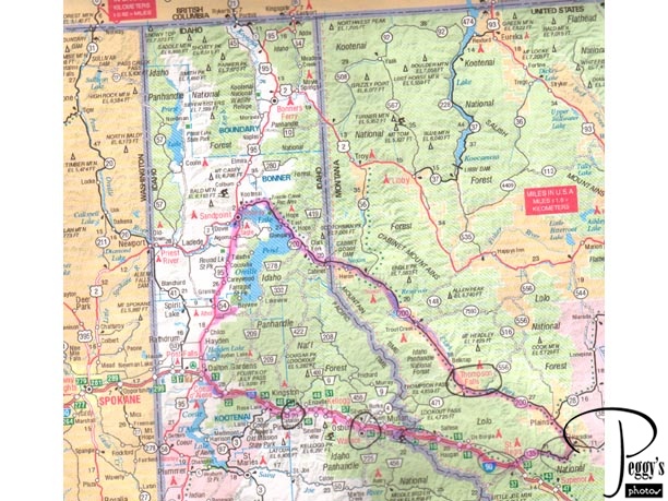
oday, after another delicious breakfast at Terry’s, Barry, Joan, and I took off for the Big Sky Country of Montana. For a very long time, I have been one of those people who said that someday I want to visit Montana. Finally, I was going to do just that. The map shows the 325–mile loop that we took––north again to Sandpoint; east then south to Thompson Falls, Montana; south and then southeast to catch the I–90; northeast to Couer d’Alene, Idaho; and then north to Bayview. We stopped at the three places marked with black full circles: Thompson Falls, Montana; Wallace, Idaho; and Cataldo, Idaho. This time we followed the GPS lady’s directions of the quicker way of getting out of Bayview, but she did make a mistake this time of directing us left at a fork in the road rather than to the right. But we had been on the road yesterday and knew she was wrong and didn’t listen to her. Otherwise, she did a great job the rest of the day.
Route Map
Enroute to Montana
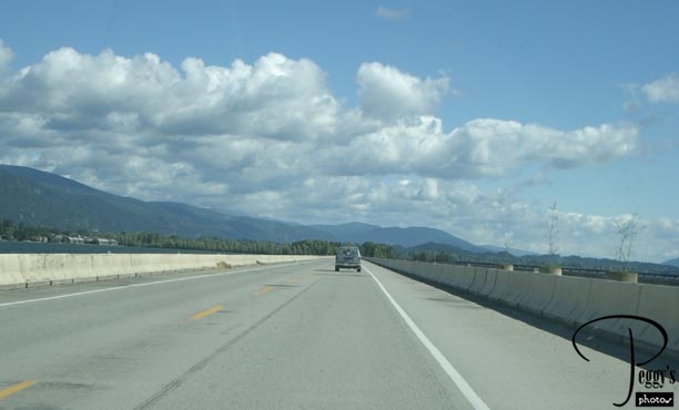
Barry took the front passenger seat again and was assigned to photo taking. Crossing Lake Pend Orielle right before reaching Sandpoint. We had sunny skies all day. (Barry’s photo)
Enroute to Montana
Enroute to Montana
We stopped at the Idaho tourist office on Lake Pend Orielle for stopover points on our scenic drive, but they only had information on Idaho. You can see the Cedar Street Public Market crossing Sand Creek in the photo, taken outside the tourist office.
Enroute to Montana
Enroute to Montana
Still in Idaho. (Barry’s photo)
Enroute to Montana
Enroute to Montana
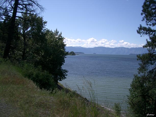
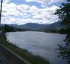
Lake Pend Orielle, Idaho. This lake was formed by glaciers. (Barry’s photo)
Enroute to Montana
Enroute to Montana
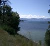
One more of Lake Pend Orielle. (Barry’s photo)
Enroute to Montana
Montana
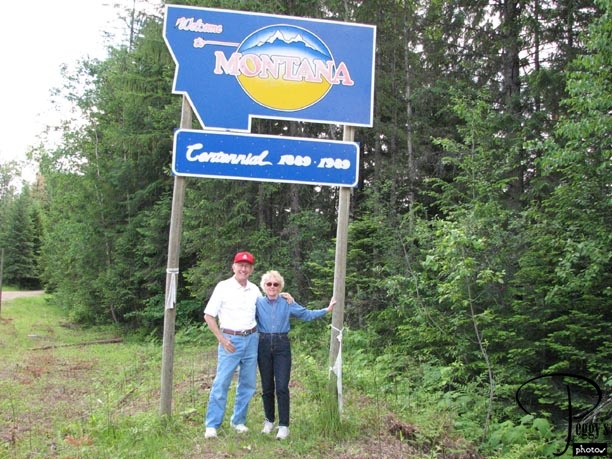
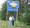
Crossing the state line. We gained an hour crossing this line as Montana is on Mountain Time.
Montana
Montana
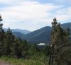
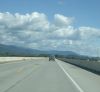
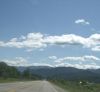
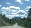
One of our first glimpses of Montana. Immediately as you cross the state line, you notice the sky and why Montana is called the Big Sky Country. The high cumulus clouds make the sky look huge. Really beautiful. (Barry’s photo)
Montana
Montana
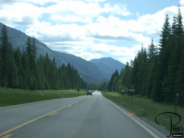
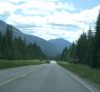
Driving through Montana. (Barry’s photo)
Montana
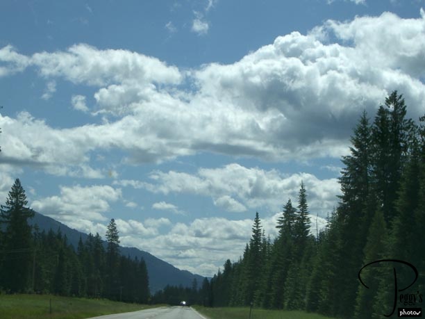
Montana
Driving through Montana. (Barry’s photo)
Montana
Montana
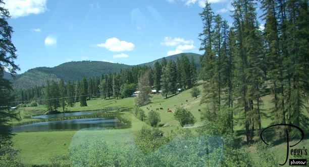
Montana valley. (Barry’s photo)
Montana
Montana
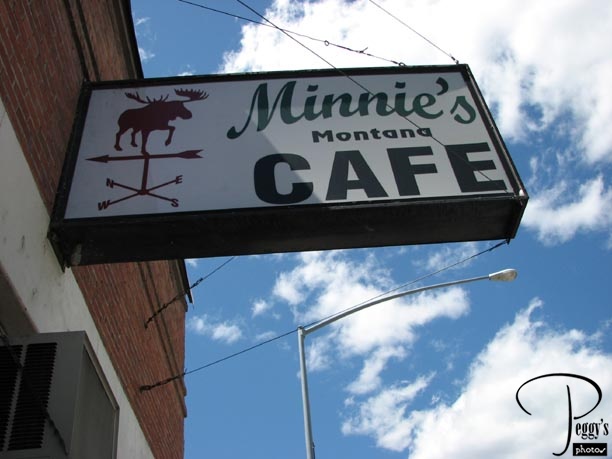
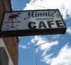
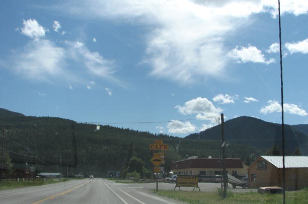
We stopped in Thompson Falls at Minnie’s Montana Cafe to have lunch. This seemed like a rather big town, population 1500, after passing through towns of probably 200–300 population, if that. Barry and Joan both had ice cream for lunch, Barry having a banana split. Not of great interest to mention but Barry told me that the banana split actually was invented in his small home town (and present residence) of Latrobe, Pennsylvannia. A good fact to know for trivia quizzes. Add to that fact, both Arnie Palmer and Mr. Rodgers were also born in Latrobe––pretty good for a small American town. We had some good laughs at our waitress’ expense, because she was so busy that I was only able to give my lunch order in intervals to her, as she would rush away right after I just gave part of my order. But soon we were her only customers (we were eating late on Idaho time) and we were able to ask her the directions to the falls at Thompson Falls. She told us there were no more falls in Thompson Falls because they were dammed up for a hydroelectric plant.
Montana
Montana
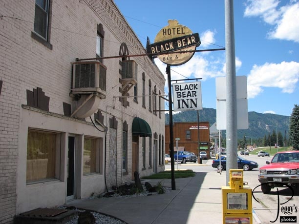
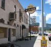
But we decided to see what was left of the falls anyway and walked past the Black Bear Inn, originally the Ward Hotel, built in 1907–08. It is on the National Registrar of Historic Places.
Montana
Montana
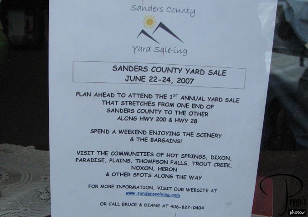
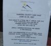
Sign in a store window advertising the First Annual Sanders County Yard Sale, extending from one end of the county to the other. From its Internet site, I found that it will be along route 200 for 116 miles from Heron to Ravalli and along route 28 for 34 miles from Dixon to Hot Springs––a 150–mile long yard sale!
Montana
Montana
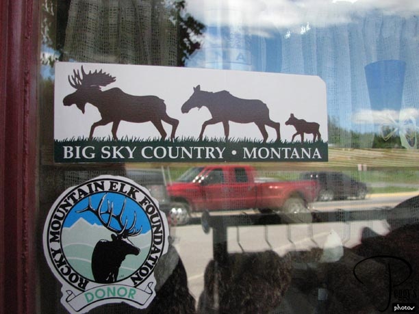
Another sign in a store window to remind you of where you are. On another sign, an interesting fact was pointed out: There are no stoplights anywhere in the 2790 square miles (7,226 square kilometers) of Sanders County.
Montana
Montana
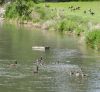
Montana
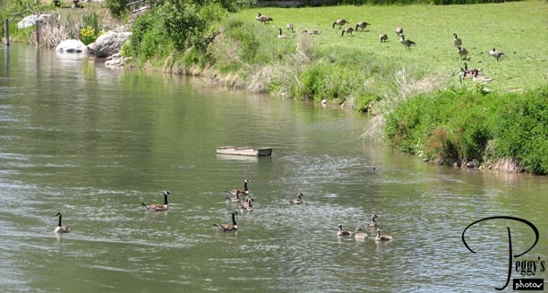
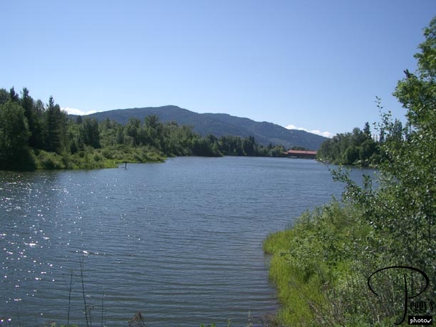
Geese on the riverbank.
Montana
Montana
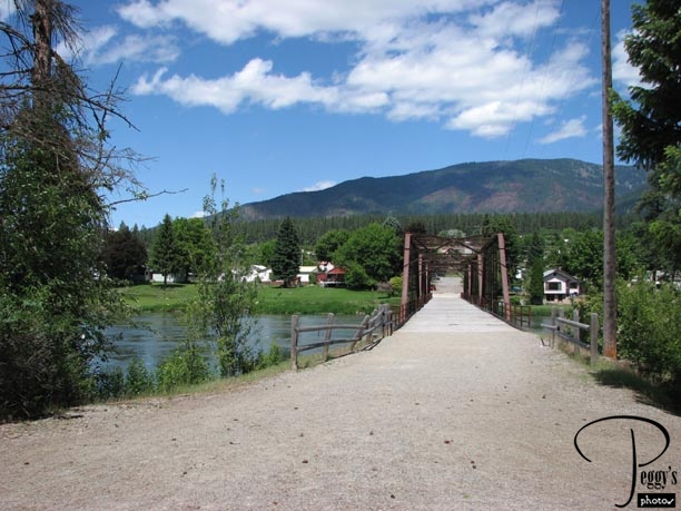
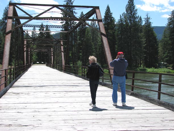
Looking back over the bridge.
Montana
Montana
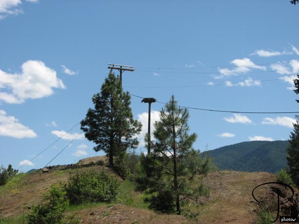
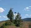
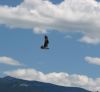
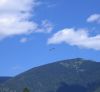
Wallking past the osprey nursery (on top of the first pole). Montana installs nesting platforms for the osprey so that they won’t build their nests on power poles, which can cause power outages and fires.
Montana
Montana
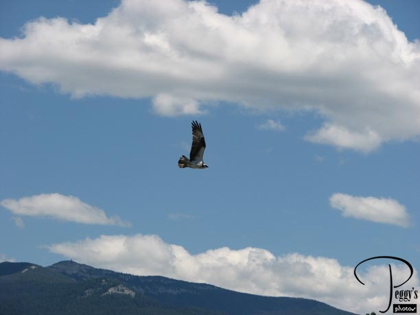
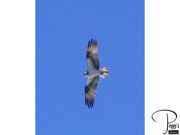
My photo of an osprey. Probably the male guarding the nest while we were walking around.
Montana
Montana
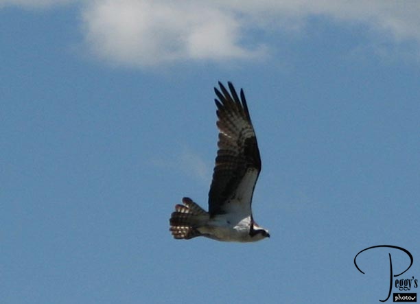
Close–up of the osprey from the last photo. Osprey are nicknamed “fish hawks,” as they eat only fish which they capture by diving feet first into the water.
Montana
Montana
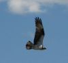
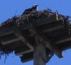
Barry’s photo of the osprey, taken with his camera.
Montana
Montana
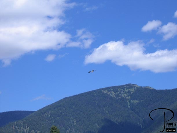
And the best osprey photo of them all––Barry’s photo.

Montana
Montana
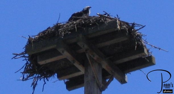
Barry got this photo of Mama Osprey in the nest with her babies.
Montana
Montana
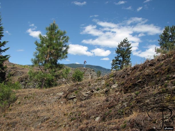
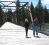
Barry was able to get that last photo by climbing up the top of a hill. There’s Barry.
Montana
Montana
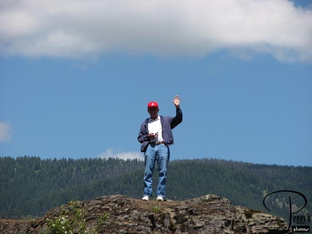
Hi Barry!
Montana
Montana
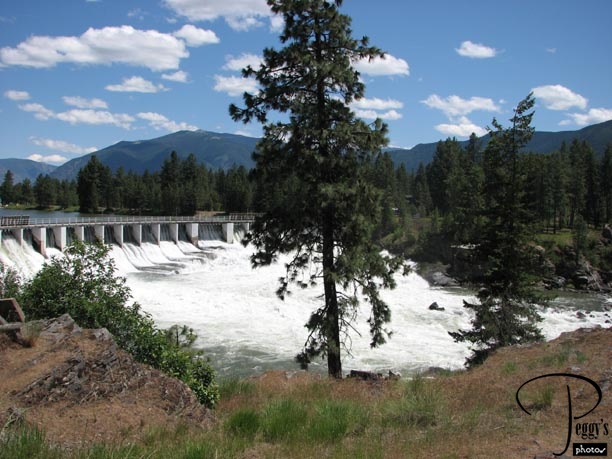
Thompson Falls. Still a pretty sight even though the water now flows through a dam.
Montana
Montana
Looking downward from the falls.
Montana
Old Mission State Park
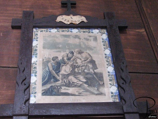
Brother Francis Huybrechts also hand–carved the frames for the Stations of the Cross.
Old Mission State Park
Montana
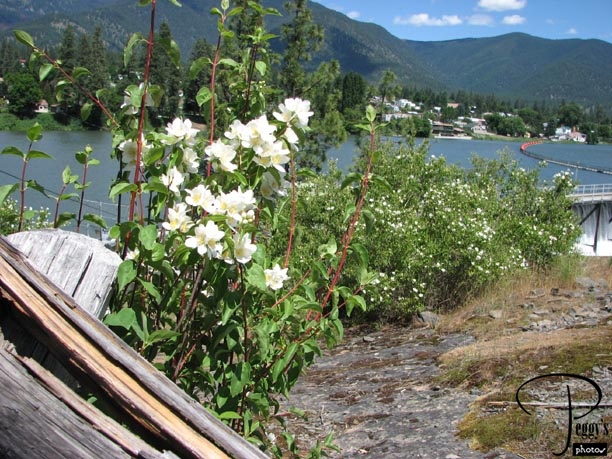
Wildflowers on the river bank.
Montana
Montana
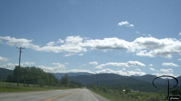
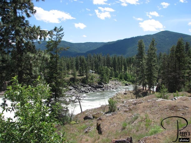
Barry took over the driving for awhile after we left Thompson Falls. There were two ways to go back to Idaho––over a winding mountain pass or a longer flatter way. We had advice as to our route around Montana from both Alan and a waitress at Terry’s, but we didn’t realize that they were different routes––Alan’s was over the mountain pass and the waitress’ route was the easier one, and we took her route as this is the one she had mapped out for us. Photo: On the way back to Idaho from Thompson Falls.
Montana
Montana
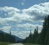
Scenic Montana.
Montana
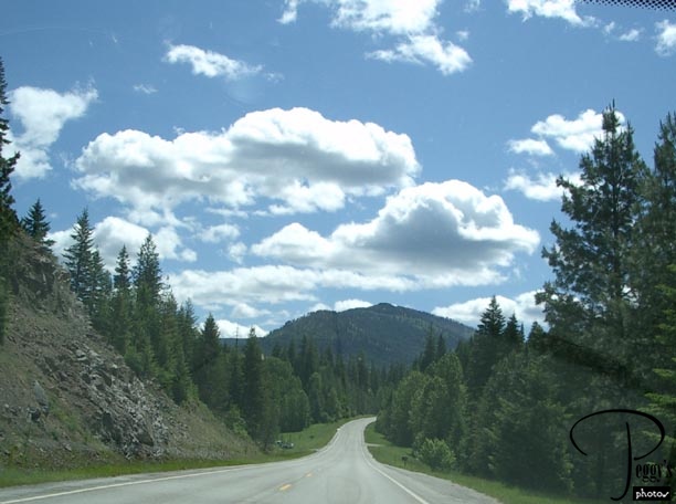
Montana
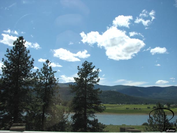
Scenic Montana.
Montana
Montana
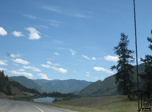
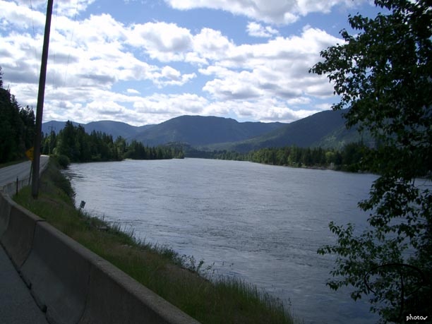
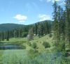
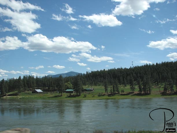
Passing a lake.
Montana
Montana
Idaho
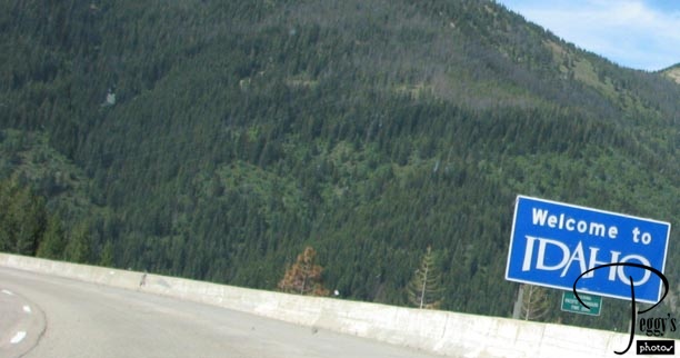
Crossing the Idaho state line. We now lost the hour that we had gained.
Idaho
Idaho

Beautiful Idaho. The rest of my photos of our journey today will be on the next album.